System hesabgaran jaban
Agriculture with satellite, a new way for farmers to adapt to new climate conditions
Satellite technology is changing the way farmers manage crops and livestock, and may also hold the key to understanding how agriculture can adapt to the effects of climate change while reducing agriculture's contribution to climate change.
Every food we enjoy eating every day and satisfying our body's nutritional needs is the result of the efforts of farmers around the world. However, the effects of climate change, such as rising temperatures, unpredictable rain patterns, and increased frequency of extreme weather events, all threaten farm productivity. It is also true that agriculture itself contributes to climate change and in fact we are facing a negative feedback cycle. In the meantime, satellite technology is one of the new and effective methods that help agriculture move towards a more sustainable future."Adaptation to climate change" refers to actions that are taken to reduce the negative effects of climate change while taking advantage of potential opportunities in new times and conditions. Achieving this adaptation requires adjusting policies and actions in response to observed or predicted changes in climate. Agriculture with satellites, or actually agriculture with the help of accurate satellite data, is one of the methods that, in the new climate, accompanies farmers in the transition from this difficult and challenging period. In this article, we will read how satellite farming happens, what dimensions it has and what challenges it faces.
The potential of precision agriculture
Precision agriculture or precision agriculture has been a growing field of technology since the 1990s.In a general definition, precision agriculture can be seen as the application of a wide range of GPS technologies, robots, drones, sensors and satellites to improve agricultural knowledge and efficiency. A more efficient farm will also be more sustainable; Because in it, the farmer achieves the ideal performance of the land by consuming less fertilizer and energy.
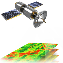
Satellites are floating up to 36,000 kilometers above us. They can see large parts of farmland and share with us a view that is difficult to understand from below and from the surface of the earth, but becomes possible in satellite farming! Satellites can help farmers make more efficient and sustainable decisions in three ways:
Mapping: Determining how large tracts of land can be used for a variety of agricultural uses.Measurement: Satellite data is fed into complex algorithms to measure and determine various product characteristics such as yield and growth stage.
Monitoring: Satellite imagery allows scientists and farmers to see how land use has changed over time, as well as detect changes in rainfall patterns.Knowledge gained from these processes can help farmers and ranchers better understand a variety of agricultural issues, such as which fertilizer to use, how much, and where on the land, or where livestock roam, the impact of new patterns. How has the weather affected the growth of the crop and satellite technology increases efficiency and reduces fertilizer consumption
We know that changing and optimizing agricultural processes can help reduce farm costs. For example, using satellite images, the Keshtyar system helps farmers in deciding the amount of fertilizer to use in the fields and how to distribute it, and reduces the amount and cost of fertilizer consumption.In the traditional way of farm management, all parts of a farm were treated equally, but nowadays the data obtained from satellite images show that the soil quality and its mineral richness are different in different parts of the farm. Knowing this is beneficial to farmers, as they can use fertilizer more efficiently and save money. But determining the variable rate of fertilization is also useful for the environment, because fertilizers (both organic and chemical) are used to a lesser extent.
